| MOUNT SAINT HELENS |
|
|
|
The following is an illustrated overview of the geology of the Mt. St. Helens area, with an emphasis on the events of the eruption of May 18th, 1980. The photos are from various field trips conducted by the author with students from Malaspina University-College, Nanaimo, British Columbia. |
To view one of the full-sized images click on the small image.
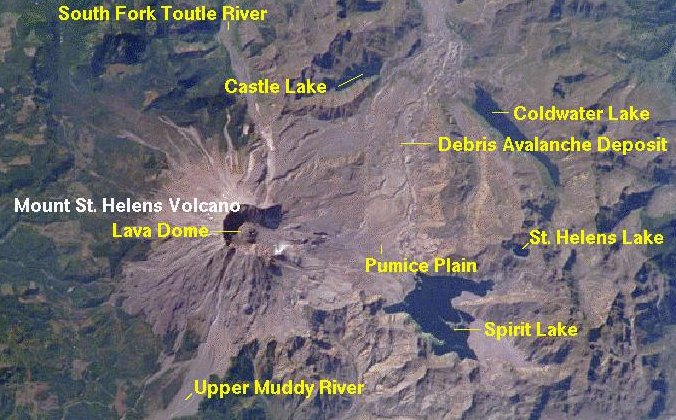 |
This NASA satellite image shows the area around Mt. St. Helens, including many of the features that are depicted in the photographs below - such as The Toutle River, Coldwater Lake, the Debris Avalanche deposits, the Pumice Plain, Spirit Lake and of course the 1980 Crater and the post-1980 Lava Dome. (image from the USGS Mt. St. Helens website - see reference below) |
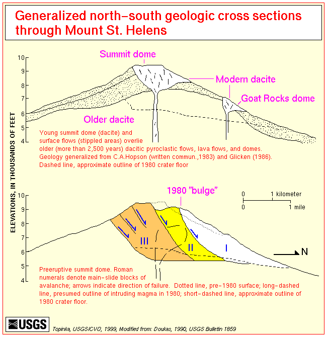 |
The sequence of events surrounding the 1980 eruption is depicted in these two USGS diagrams. In the months leading up to May 1980 magma from beneath Mt. St. Helens was moving into a small magma chamber on the north side of the mountain - producing a pronounced, and increasingly unstable bulge. Just after 8:30 AM on the 18th of May a magnitude 5.1 earthquake triggered a massive landslide in which the side of Mt. St. Helens collapsed, in three separate blocks, sending an avalanche of debris into the valley below. (image from the USGS Mt. St. Helens website - see reference below) |
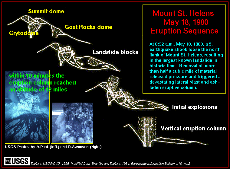 |
The collapse of the mountainside exposed the small magma body which had been forming beneath the bulgem (the cryptodome), and the sudden release of pressure led to a huge explosion, known as a lateral blast. The lateral blast was followed by a vertical "plinian" eruption which extended well into the stratosphere, and sent ash and gases around the world. The vertical eruption continued for about 9 hours, and produced numerous pyroclasitc flows. (image from the USGS Mt. St. Helens website - see reference below) | |
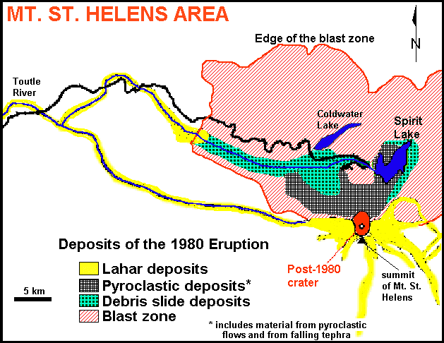 |
The lateral blast levelled around 600 square km of forest (blast zone). Material from the pyroclasitc flows and from falling tephra from the vertical eruption blanketed the area immediately to the north of the crater (the pumice plain). Numerous lahar floods were also produced during the eruption, first from water released from the debris avalanche, and then from ice and snow melted by the eruption and pyroclastic flows. |
| Pre-1980 volcanic features on the south side of Mt. St. Helens |
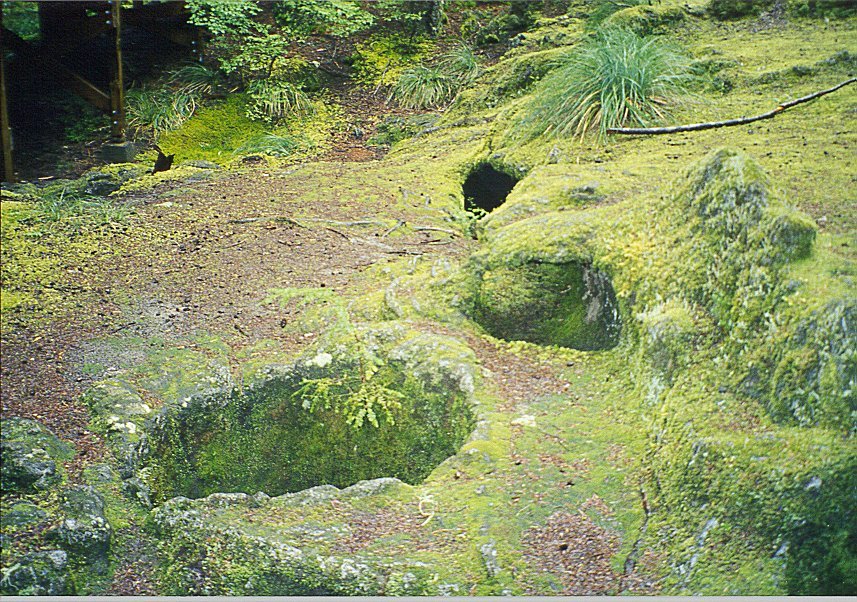 |
An eruption of basaltic magma (roughly 2000 years ago) produced numerous lava-flow features on the southern side of the mountain. There is also evidence of older lahars and pyroclastic flows in this region. In an area known as the Trail of Two Forests lava flowed around an existing forest and killed the trees. |
 |
The trees have since rotted away, leaving open vertical holes where they once stood and horizontal tunnels where the trunks were lying on the ground. |
 |
Imprints of the bark of the trees are evident on the insides of the tunnels. |
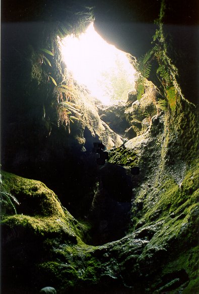 |
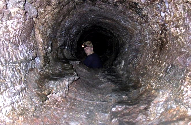
The same lava flowed into a nearby stream valley. Lava in contact with the ground and the air hardened quite quickly, but it continued to flow through a tunnel, which is now known as the Ape Cave. The cave is around 2 km long, and in places is over 5 m wide and 5 m high. |
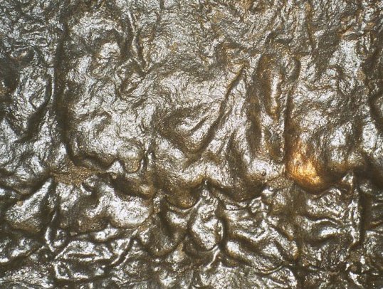 |
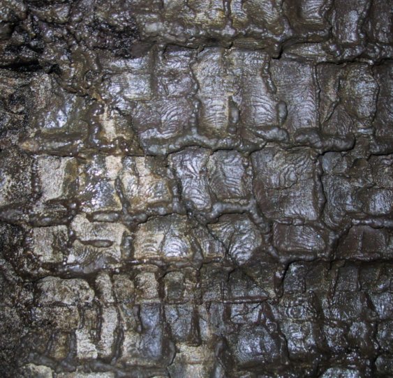
Magma flowing through the tunnel spattered against the sides and roof, and then dripped down the walls. |
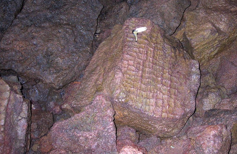 |
There are also imprints of tree bark within the cave. |
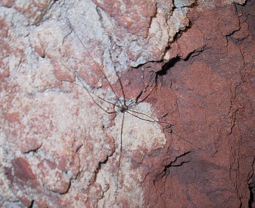 |
The cave is home to bats, spiders and a few other timid creatures. The red colour seen here is a product of oxidation of existing materials under the hot conditions related to the lava flow. |
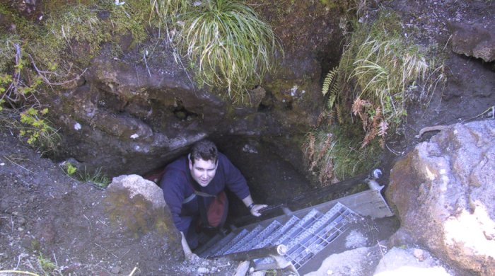 |
There are stairs and ladders to get in and out of the cave, but the cave itself is quite an easy hike. |
| More lava flow features on the south side of the mountain |
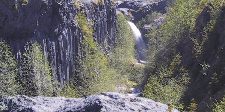 |
Lava from the same event around 2000 years ago flowed into the valley of Castle Creek and is now exposed in this spectacular canyon. |
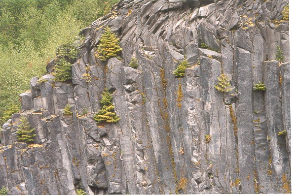 |
Columnar basalts formed as the thick layer of lava cooled. |
| Tephra, pyroclastic flows and lahar deposits |
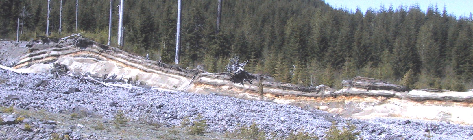 |
A major lahar flow associated with the 1980 eruption sped down a stream valley on the southeastern side of the mountain and exposed an area with some spectacular deposits of pre-existing tephra depostis, lahar and pyroclastic flows. |
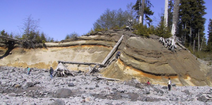 |
On some of the standing trees in the upper right of this photo you can see the scars which were caused by the 1980 lahar. |
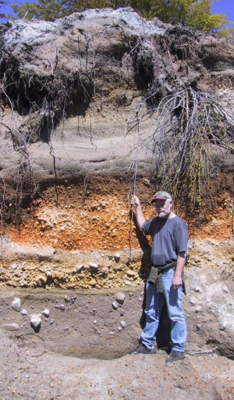 |
The bouldery material at the bottom of the sequence is from an old lahar. That is overlain by the deposits of two separate tephra falls (yellow and orange colours) and then by pre-1980 lahar deposits. The 1980 lahar deposits are visible at the top. |
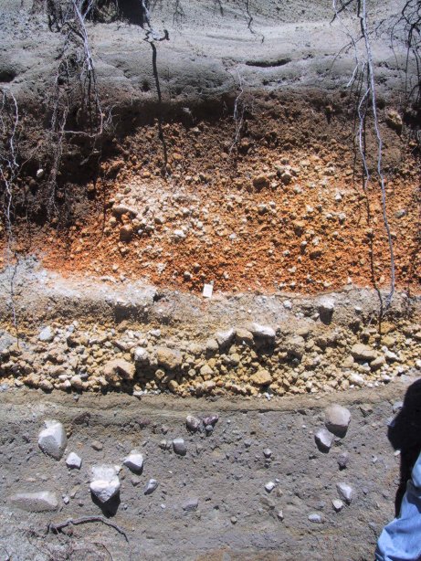 |
The characteristics of the three types of deposits are more clearly visible in this photo. |
| The effects of the 1980 eruption |
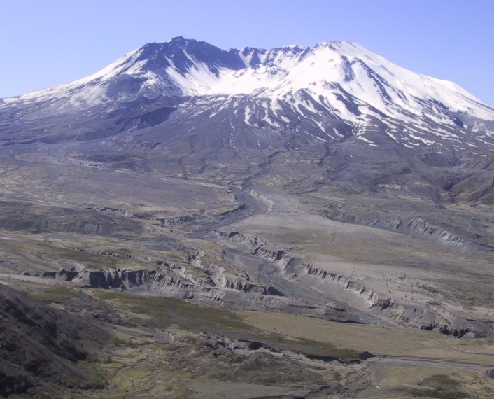 |
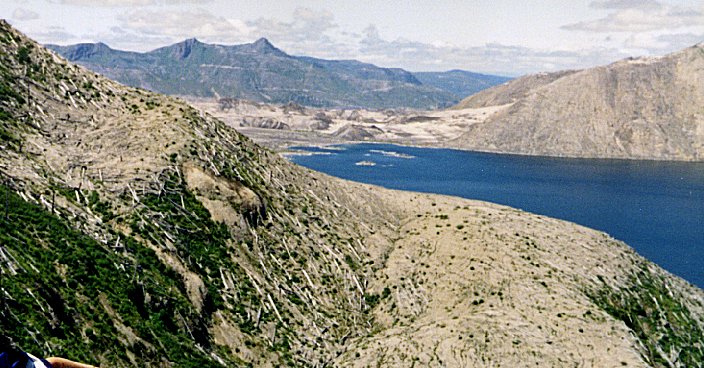
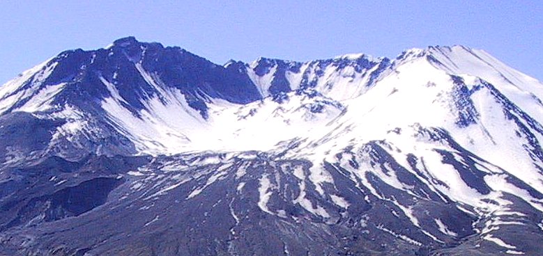
This view is from Johnston Ridge into the crater about 10 km away. David Johnston was observing the mountain from this perspective on May 18th. He would have had a spectacular view of the beginning of the debris avalanche, but he was killed very quickly by the lateral blast. His last words, by radio to the USGS office in Vancouver Washington, were: "Vancouver, Vancouver, this is it!" The area in the foreground is known as the Pumice Plain, which consists of thick deposits of tephra, from the main vertical eruption and from pyroclastic flows. |
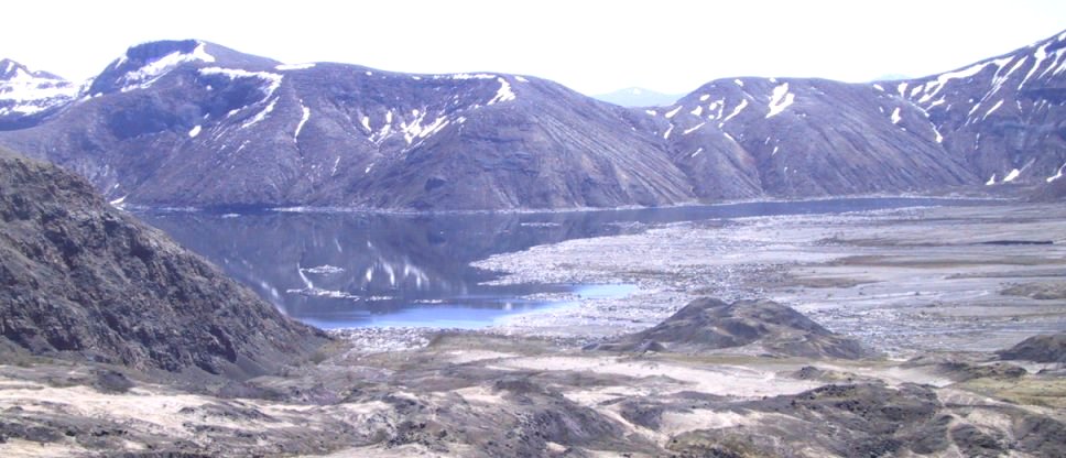 |
From the eastern end of Johnston Ridge you can look down into Spirit Lake, still partly covered with logs and debris from the 1980 eruption. The lake is quite a bit higher than it used to be, as it was dammed by the debris avalanche, part of which can just be seen on the right of this view. |
 |
This is another view of Spirit Lake from the other direction. Mt. St. Helens is to the left of this view. Note the blown-down trees on the left. At the time when this was taken the floating debris in the lake had blown to the other end of the lake (to the right of this view). (photo courtesy D. Wilford) | |
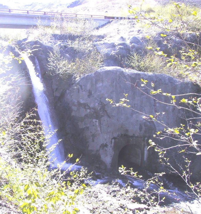 |
As the water level in Spirit Lake rose during 1980, authorities became concerned that it represented a serious flood threat, since it was being held back only by the loose deposits of the debris avalanche. The US Army Corps of Engineers excavated a 2.6 kilometre long tunnel from the lake into the valley of Coldwater Creek. The outlet of that tunnel can be seen here to the right of the waterfall. See: https://www.nwp.usace.army.mil/op/b/msh/msh_tunnel.htm |
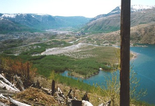 |
The Debris Avalanche also created Coldwater Lake. Part of the debris material can be seen in the background of this photo. The partly tree-covered fan area in the centre is a delta built up in Coldwater Lake from the huge amount of sediment in Coldwater Creek, which emptied directly into the lake for a number of years. You can see how the near part of the delta, with the bigger trees, was formed first. |
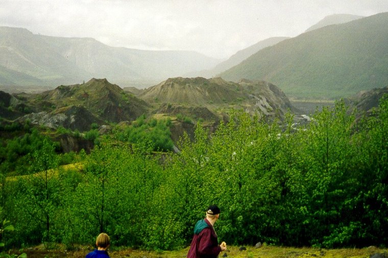 |
As it came to rest the Debris Avalanche formed an extensive area of hummocky terrain. The hummocks are now being eroded by water. This photo was taken close to Coldwater Lake | |
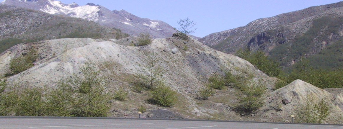 |
The debris avalanche is primarily made up of parts of the existing side of Mt. St. Helens, and as can be seen here that includes a variety of different materials (with different colours). The various rock types of the existing mountain did not get entirely mixed during the descent of the debris avalanche. | |
 |
This is Coldwater Creek about a kilometre upstream from Coldwater Lake. This is a good example of a braided stream, a feature which is characteristic of streams with excessive sediment loads. The sediment is derived from the rapid erosion of the massive amount of pyroclastic material dumped into this area on May 18th. In the background you can see more of the hummocky terrain of the debris avalanche. |
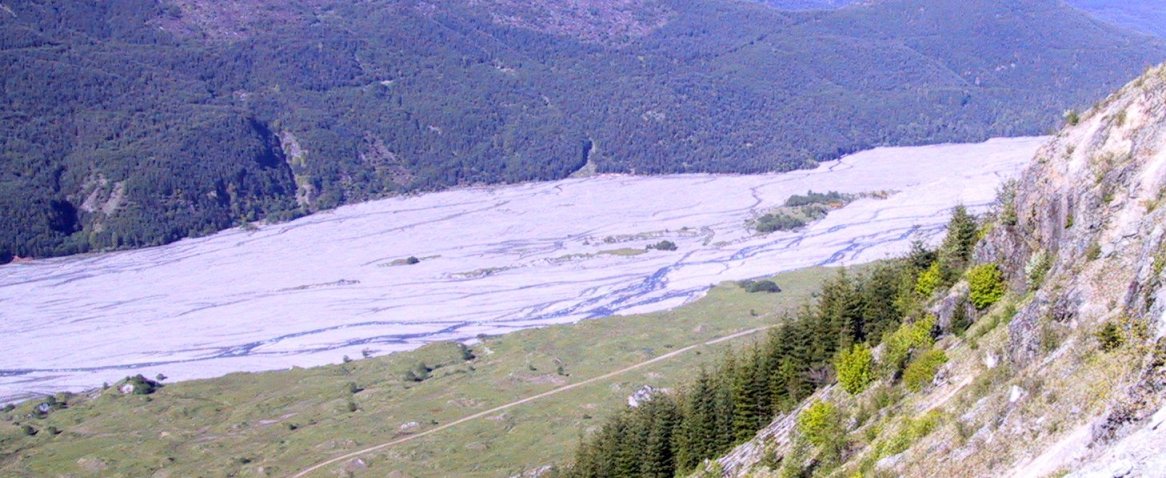 |
The north fork of the Toutle River is also choked with a huge volume of sediment. This view is about 25 km down stream from the crater area. |
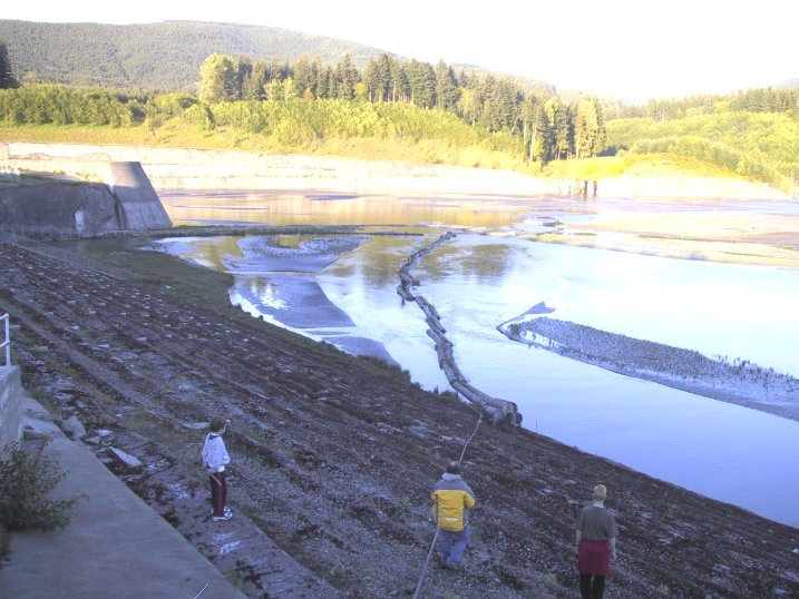 |
About 30 km further down stream the US Army Corps of Engineers built a dam on the Toutle River. The dam - known as the Sediment Retention Structure - has created a small reservoir which allows some of the Toutle's heavy sediment load to settle out. See: https://www.nwp.usace.army.mil/op/b/msh/msh_srs.htm |
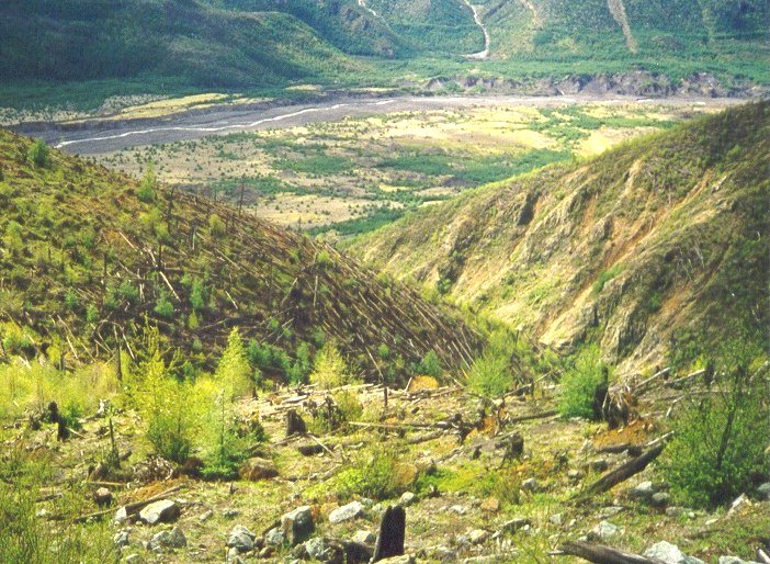 |
This picture was taken near to the edge of the blast zone, looking down into the valley of the Toutle River - approximately 20 km from the crater. All of the large trees that were standing in this area were blown over, and if you look carefully you can see how they all fell in the same direction. |
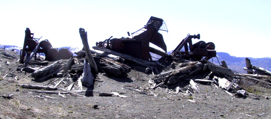 |
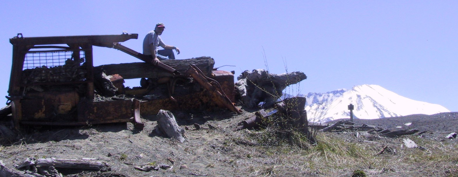
There was logging operation going on at this site, some 10 km from the crater. Fortunately there were no workers in here on Sunday the 18th, although the logging equipment was destroyed by the lateral blast. | |
 |
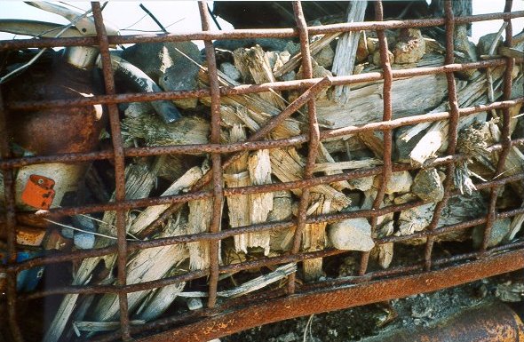 |
This is some of the material that was lodged in the back of the cab of the tractor shown in the previous image. Picked up by the force of the lateral blast, it would have been flying through the air at hundreds of km/h. |
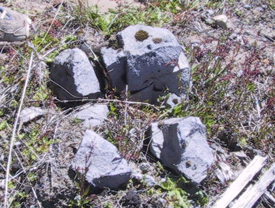 |
This chunk of dacite is part of what is known as a bread-crust bomb - so-named because the outside has the texture of baked bread. It was hurled out of the volcano during the main vertical eruption, hardened in the air, and landed on the ground here, roughly 10 km from the crater. |
| Events since 1980 |
 |
From 1980 until around 1990 there was a great deal of volcanic activity within the crater, including some explosive eruptions and growth of a significant lava dome. Things have been quite quiet since 1990, but there is still a lot of heat, and some active hot springs. A new glacier is starting to form on the shaded walls of the north-facing crater. | |
 |
Much of the area around Mt. St. Helens has been declared a National Volcanic Monument - a status similar to that of a National Park. No reclamation has been carried out within this area. It is being left as a natural laboratory so that we can observe how regeneration takes place. Much of the region looks barren, but it is full of life! |
Other Mount St. Helens information:
The best website on Mt. St. Helens is from the Cascades Volcano Office of the U. S. Geological Survey: http://vulcan.wr.usgs.gov/Volcanoes/MSH/framework.html
There is a wealth of information there, plus a page of links to other resources on Mt. St. Helens and other volcanoes.
I also strongly recommend the field guide: Roadside Geology of Mt. St. Helens National Volcanic Monument, by Patrick Pringle, Washington Department of Natural Resources, Information Circular 88, 1993.
Steven Earle, Department of Geology, Malaspina University-College, Nanaimo, B.C., http://www.mala.bc.ca/~earles
November 2001